

So said poet John Masefield By far the most tantalising problem confronting mariners for centuries was how to calculate Longtitude. Today we take latitude and longtitude for granted. We all know what they are but by far, of all the problems that have confronted mankind waiting to be solved by men of science, Longtitude was the most insoluble ever.
It took over 2,000 years for a workable solution to be developed and in the intervening years it was the cause of huge and consistent loss of life at sea.
Longtitude is the measure of distance in degrees either East or West of Greenwich. On a map it is depicted as the lines that run from pole to pole. It is the converse of Latitude which is the measure of distance in degrees north or south of the equator. Both measures are based on a circle of 360 degrees and are known as meridians of longtitude and parallels of latitude. In the case of longtitude the starting point is called the Prime Meridian which is 0 and runs through the Royal Observatory at Greenwich in England. Positions of longtitude are expressed either as X degrees east or X degrees west meaning east or west of Greenwich.
Longtitude and latitude are both expressed as degrees of a circle given that the Erath is spherical although longer around the Equator than through the poles. The degrees are never expressed in terms of more than 180 degrees in the case of longtitude and 90 degrees in the case of latitude. Thus a position of longtitude is always expressed as being east or west of Greenwich. Notionally, the International dateline is 180 degrees from Greenwich and at that point the designation of east and west changes.
Similarly latitude is never more than 90 degrees because the section of the earth from equator to a pole is a quadrant and degrees are said to be either north or south of the equator but the entire system is based on a circle of 360 degrees in each direction.
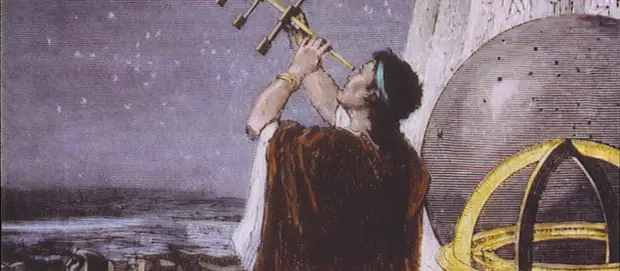
Very early in maritime history the ability to calculate latitude was solved by measuring the angle of a heavenly body such as the moon, a star or the sun in relation to the horizon at a given time. Calculation became simple with the invention of the sextant in the late 17th and early 18th centuries.

John Hadley invented his "reflecting quadrant" in 1731, the direct ancestor to the modern sextant. Called a reflecting quadrant for most of the 18th century and quadrant in 19th century America, it actually has an arc of 45 degrees hence its modern name of octant. Instead of working with sun shadows, the octant used mirrors to line up a reflection of the sun or other celestial object with the horizon. It could be used for star sights, which was a major advantage. It evolved into the sextant about 1757 but continued to be made into the middle of the 19th century.
Mariners sailing within sight of land could always fix their position by lining up known landmarks but once out of sight of land the problems of fixing position became immense. Apart from the hazards of sailing in unknown waters other problems such as lack of food and water manifested themselves with ships masters not knowing when they would be able to replenish stores.
The solution to latitude was only part of the problem confronting early European mariners. Long before the expeditions of the European explorers the Vikings, Pacific Islanders and Chinese had their own methods of celestial navigation.
The methods used by European explorers was totally different. They understood what was needed but had not developed the means to measure it. In the early days of Dutch exploration of the Australian coast and voyages to Batavia the simple method was for a ship to sail south into the latitudes of the roaring 40’s, the freezing 50’s or the screaming 60’s referring to 40,50 or 60 degrees south latitude.
When they reached the desired latitude they turned east and estimated the number of days sailing and distance covered then turned north hoping to land at Batavia or some other East Indies port. This flawed method had hundreds of ships wrecked on the coast of Western Australia because they had travelled too far east. The Western Australian coast is a maze of reefs and shoals for almost its entire length and the skippers of those ships were all sailing blind so that safe arrival at Batavia was more a case of good luck than good management.

A similar situation applied to the Shipwreck coast of western Victoria where ships had to thread a needle between the mainland and King Island at the entrance to Bass Strait. The roaring 40’s pass directly through Bass Strait and ships had to contend with, not only the guess work of determining longtitude but the hazards of a lee shore when violent storms were encountered which was the norm rather than the exception. There are about 650 wrecks along the Shipwreck coast but most have been the victims of storms rather than navigational imperfections.
However in the early days of voyages to Melbourne there were no lighthouses or other navigational aids and the coast had not been properly charted until Matthew Flinders made his circumnavigation of Australia in 1802/03
It was recognised by mariners that the solution to fixing longtitude was the measurement of time and distance. Both were matters of imprecise science. The problems of solving both were inherent in the fact that a ship at sea, frequently big sea in those latitudes, was not a stable platform. It was constantly heaving and rolling.
The more important factor is being able to measure time. There is a direct connection between longtitude and time at any given location. Longtitude is represented by 15 degrees of longtitude being equivalent to one hour difference in local time Thus with an accurate and reliable timepiece longtitude can be determined from a known starting point or from the local time difference between a known celestial event such as an eclipse of the moon taken from two separate locations.
Each degree of longtitude is divided into 60 seconds which in turn is divided into 60 minutes, the same as a clock. At the equator, one degree of longtitude is 60 geographical miles. Due to the curvature of the earth the distance between the meridians reduces as well until, at the poles the difference is 0. There are formulae for calculating these distances at any given latitude but they are too complicated for the average reader to comprehend. Today, with the advent of GPS and satellite navigation systems, these calculations are presented automatically thus eliminating the tedious and error prone human calculations.
The Greek astronomer, Hipparchus, worked on developing a concept of longtitude in the 2nd century BC, long before the notion of a flat earth pervaded European thinking. He assumed that the earth was spherical and his prime meridian ran through Alexandria. Ptolemy was also developing a similar system with the prime meridian passing through the Canary Islands but the fall of the Roman Empire brought these efforts to an end.
It was not until the later Middle Ages that interest was again aroused. Arab scholars developed their own sets of astronomical tables based on lunar eclipses. Christopher Columbus was investigating longtitude determinations on his various voyages based on lunar eclipses but they resulted in large margins of error when studied more closely when he returned to Spain.
In the mid-18th century the development of the pendulum clock and the telescope gave far better results with consistent accuracy of less than 1%. The problem was that these methods worked well on land where the instruments were set on a firm base. On a ship at sea the position was quite different and the pendulum clock, in particular, was not a solution.
The longtitude problem was so serious for the maritime powers of Europe that they offered prizes for any solution. In England, the British parliament passed the Navigation Act in1714 which awarded substantial rewards for solutions accurate to within 1 degree and 0.5 degrees.
The breakthrough came when a Yorkshire carpenter and clockmaker named John Harrison built a chronometer followed by four more over the next 30 years funded by awards from the Board of Longtitude.
The early chronometers were expensive but their data simplified the tedious calculations needed to determine longtitude using lunar methods. It has been claimed by some writers that Captain Cook had on board secretly a Harrison chronometer to test its reliability and accuracy. The secrecy was needed because of the rewards on offer from the Board of Longtitude to the first discoverer of a better solution. However, these claims are taken with a grain of salt because Cook’s voyage was in 1769 and Harrison’s first clock was built in 1736.Harrison’s original chronometer which became the standard instrument can still be seen today at the Science Museum in London. It is owned by The Worshipful Company of Clockmakers. It is still in working order. It and the next two, were made entirely of wood.

It is a recorded fact however that Cook did trial a Harrison invention known as a sea watch on his second and third voyages of discovery. The sea watch was a further development specifically for calculating longtitude at sea.
The watch in question is known as H4 and Cook had a copy named K1. A second copy named K2 was loaned to William Bligh for his ill-fated voyage on the Bounty. At the time of the mutiny. Fletcher Christian took this watch off Bligh. It was recovered from Pitcairn Island in 1808 and today resides in the National Maritime Museum in London. I suspect this really is the watch that gave birth to the story of Cook secreting a Harrison chronometer on board the Endeavour.
The H4 took Harrison 6 years to build. When finished it was tested on a voyage from England to the Caribbean and back. It was found to be accurate to 1/3 of a second per day of the 88 day voyage. The Board thought that was a fluke and instead of awarding Harrison, it demanded a second trial.
The Board of Longtitude offered awards of up to 20,000 pounds (about 3 million in today’s money) for inventions that solved the longtitude problem. Harrison had difficulty in obtaining his just deserts from the Board but finally parliament stepped in and awarded him a gratuity of 18,750 pounds. In a public poll taken in 2002 for the 100 most significant Britons ever, Harrison was listed number 39.
The next major development came in the early 1900’s when radio telegraphy was developed and time signal stations were established in key locations around the world. This meant that local times at these places could be transmitted to ships at sea thus eliminating the need for the lengthy and complicated calculations then in vogue. From that point on longtitude was no longer a problem. Taking into account the efforts of the Romans up until 1910 when the radio beacon in Paris was completed, it had taken over a century for the problems of longtitude to be mastered.
Notwithstanding the problems he had with the Board over his H4 sea watch, Harrison was very well rewarded during his lifetime by the grants made by the Board and he died a very wealthy man.
BLOG COMMENTS POWERED BY DISQUS


